|
Settle
Round
Starting point and OS Grid reference:

Settle SD 820634 – Large pay and display cp.
|
Ordnance Survey Map
OL2
Yorkshire Dales - Southern and Western Areas.
Buy
this map from
List
of OS Maps
Note: If you use OS Maps on-line, you can download this route via this
link.
| |
Distance: 10 miles
|
Date of Walk: 24 November 2010
| |
Ascent:
Descent:
See Walking Time Calculator
|
1760ft (537m)
1762ft (537m)
| |
Traffic
light rating: 

(For explanation see My
Walks page)
| |


For advice on .gpx files see
My Walks page
|

Click
the PDF logo above to give a printable version of this walk without the
photos.
|
To
view route as a dynamic Ordnance Survey map click here.
Introduction:
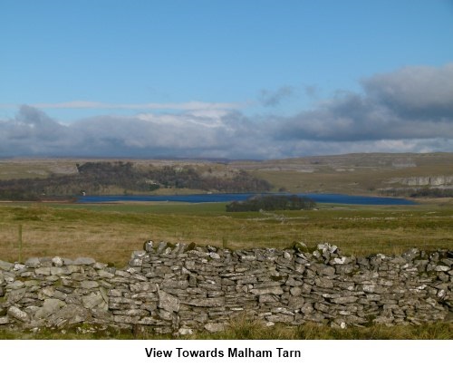
This is a lovely, easy to
follow walk from Settle which shows off some magnificent limestone scenery
and an impressive cave.
This walk starts from the
large car park in Settle (SD 820634). To find this, turn east off the B6480
in the centre of Settle along Chapel Street. At the little crossroads, turn
right along the narrow road Chapel Square, which leads to the pay and display
car park. Charges are modest.
Start: Boot up and walk back
along Chapel Square, straight across the small cross roads along High Street,
then turn right up Castle Hill, which becomes Highway. Watch out for the fork
at a telegraph pole. Highway branches left and you want the broad track on
the right (SD 822638).
Follow this track as it
gently climbs and there are some magnificent views back over Settle. Follow
this track for half a mile towards Langcliffe, ignoring the first track you
come to on the right (SD 823641) which climbs steeply and will be your
return route.
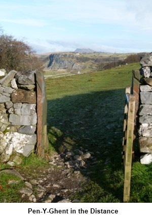
You will soon have good
views of Pen-y-ghent
straight ahead.
At the next fork (SD
824646) bear right. This junction is easy to miss, as the better used track
descends to Langcliffe. As a guide to where to branch off, look out for a
group of trees on the left with a barn in front and branch off just after the
barn. You need to be climbing
towards a copse of trees. Pass through the trees and
follow the path alongside a second group of trees coming out on to a
road at SD 830653.
Turn right and where the
road immediately sharply turns left, at the corner is a broad stony track
straight ahead. Follow this broad track alongside the stone wall, ignoring
the rather indistinct footpath to the left at the first gateway. You will
pass a barn to the right of the track (over the wall).
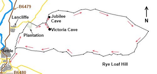
About 200/300 yards
beyond the barn is a footpath to the right (SD 837653). It is worth making a
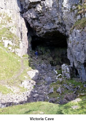
short detour here to see Victoria Cave (SD 838650). It is only around a
quarter of a mile each way. A signpost marks the way. The cave is just off
to the left of the main path. A notice board warns you that the mouth of the
cave is unsafe and describes some of its history. Prehistoric remains were
found there and it gets its name from the fact that an inner chamber was
discovered on Queen Victoria's accession day in 1837.
After looking at the
cave, retrace your steps to the main stony track and turn right. Stay on
this track as it scribes a broad easterly arc. For some distance it runs
along the right side of a wall. After a mile (SD 852658 ), it swerves away
from the wall, towards Gorbeck. Stay on the main track and ignore a path on
the left just after passing through the second wall.
Continue on the path and
turn right at the next footpath (signed), towards Settle (SD881650).
At the next junction of paths, go right (SD 875640) and also at the
junction after that, passing to
the north of Stockdale Farm, before joining the farm track and turning right.
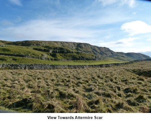
The track becomes Stockdale Lane and where it turns shaply left, there is a
gate on the right (SD 848638). Follow this track through the nature reserve
and below Attermire Scar. Along this route is some of the best limestone
scenery in the area.
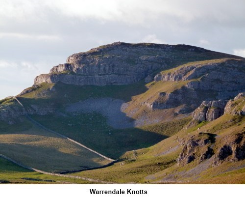
Remain on the track below
the scars, ignoring a crossing North/South track, gradually descending
towards Settle. 1.7 miles after leaving Stockdale Lane, turn left (SD
823642) where there are good views of Warrendale Knotts. You shortly rejoin the broad track back to the junction with
Highway and the road back into Settle.
If
you need to buy any hiking equipment/clothing before your trip see the Hiking
Store
All information on this
site is given in good faith and no liability is accepted in respect of any
damage, loss or injury which might result from acting on it.
|


.jpg)
.jpg)
.jpg)