|
Ilkley
To Skipton (Linear Walk)
Starting point and OS Grid reference:

Starts
at the bus/train station in Ilkley (SE 119476)
|
Ordnance Survey Map
OL2
Yorkshire Dales - Southern and Western Areas & Explorer 297 - Lower
Wharfedale.
Buy these maps from
List
of OS Maps
Note: If you use OS Maps on-line, you can download this route via this
link.
| |
Distance:
9.4 miles
|
Date of Walk:
14 January 2011
| |
Ascent:
Descent:
See Walking Time Calculator
|
934ft (285m)
895ft (273m)
| |
Traffic
light rating: 

(For explanation see My
Walks page)
| |


For advice on .gpx files see
My Walks page
|

Click
the PDF logo above to give a printable version of this walk without the
photos.
|
To
view route as a dynamic Ordnance Survey map click here.
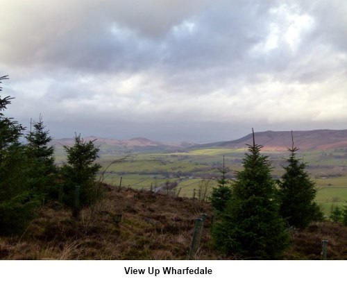
Introduction:
This walk
rather annoyingly spans more than one map but to be honest it is such an
easy route to follow a map is not really essential at all. It is a linear
walk beginning at the bus/train station in Ilkley (they are next to each
other) and a bus can be caught back to Ilkley from Skipton. For much of its
length, it follows an ancient route across Addingham and Skipton Moor on a
broad track. You see the River Wharfe between Ilkley and Addingham,
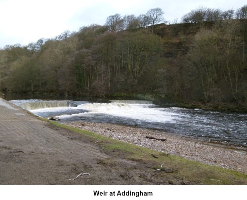
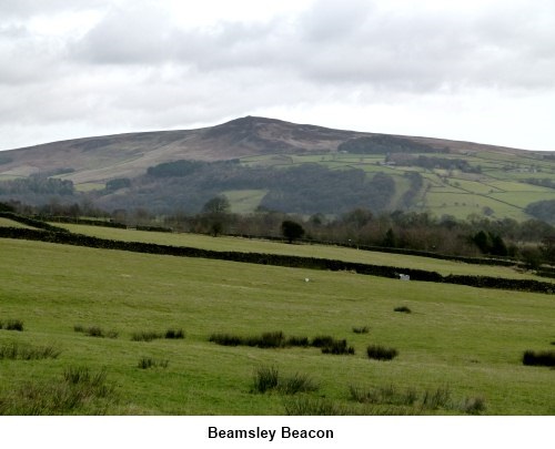
Addingham weir and church and the walk over the moors offers good views
across to Beamsley Beacon and the Wharfe Valley.
Start: Turn left out
of the station (s) and at the roundabout, turn right down Brook Street. At
the traffic lights turn left then the next right Bridge Lane to take you
down to the river. Keeping the river on your right, follow the road along
past the old bridge and by the plant nursery is a footpath which is the
start of the Dalesway long distance footpath to Bowness in the Lake District
(SE 112481).
The
footpath exits after a short distance into the drive to Ilkley tennis club.
Turn right along the drive and look out for the Dalesway sign through a gate
on the left before you get to the clubhouse (SE107483). Follow the clear
footpath through the fields and when it reaches the river, follow the river
bank until the path exits into the old Ilkley Road to Addingham.
Turn right
along the pavement and take the next right along Old Lane (SE 090489). After
pausing at the bend to view the weir, continue along Greaves Smithy (first
right round the bend) which becomes Low Mill Lane. Look out for a footpath
on the right indicated by a Dalesway sign (SE 085496). Follow this and pass
in front of the church. Look out for an information board on the right hand
side after the church which tells you about Christian worship in Addingham.
Behind it is a short footpath between the houses. This takes you into North
Street where you turn left then immediately right into Church Street.
Stay on
Church Street until you reach Addingham Main Street and turn right. Walk
through the village and branch off to the right by the Craven Heifer pub
along Skipton Road. Take the next left, Moor Lane (SE 071501). Essentially
you now simply keep straight ahead all the way to Skipton, ignoring any
footpaths/tracks to either side.
Moor Lane is
interrupted by the main road village by-pass which you cross and continue
along the metalled road (still Moor Lane) as it begins to rise.
Eventually, the
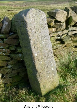
tarmac gives way to a stony track which continues to rise until it reaches a
minor road where there is an ancient milestone (SE 040511). Cross this road
and the track levels out and continues straight ahead, becoming a walled
track and passing a plantation on the right before descending through some
trees.
The path
exits at the end of Shortbank Road (SE 002512) and you walk downhill into
Skipton passing the old toll house on the right. Turn left at the end of
Shortbank Road along Newmarket Street into the centre.
If
you need to buy any hiking equipment/clothing before your trip see the Hiking
Store
All information on this
site is given in good faith and no liability is accepted in respect of any
damage, loss or injury which might result from acting on it.
|


.jpg)
.jpg)
.jpg)