|
Win
Hill and Ladybower Reservoir
Starting point and OS Grid reference:

ope Village SK171835 - Pay and Display cp.
|
Ordnance Survey Map
OL1
The Peak District – Dark Peak Area.
Buy this map from
List
of OS Maps
Note: If you use OS Maps on-line, you can download this route via this
link.
| |
Distance: 9.5 Miles
|
Date of Walk: 21 October 2010
| |
Ascent:
Descent:
See Walking Time Calculator
|
1758ft (536m)
1758ft (536m)
| |
Traffic
light rating: 

(For explanation see My
Walks page)
| |


For advice on .gpx files see
My Walks page
|

Click
the PDF logo above to give a printable version of this walk without the
photos.
|
To
view route as a dynamic Ordnance Survey map click here.
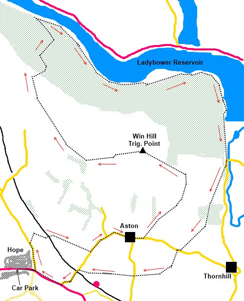
Introduction:
This relatively easy walk gives good
views of the Edale valley from Win Hill and takes you along the shore of
Ladybower Reservoir built between 1935 and 1943 and took two years to fill!
The villages of Ashopton and Derwent disappeared beneath.
There are good views to Mam
Tor and Stannage
Edge.
Start the walk in the village of Hope.(SK171835) where
there is a pay and display car park opposite Hope Garage.
Start: Turn right out of the car park and take the left turn on
the road to Edale alongside the Old Hall hotel. Walk along this road until
you see the road on the right signposted Hope Cemetery (SK 172839). Take
this track.
Turn right at the second junction on this track and go
under the railway. Continue passing Fairfield Farm on the left until you
reach the road (SK 180838 ). Turn left.
Walk along the road for half a mile and just past Aston
Hall and a road off to the right, turn left on to a footpath (SK 187839).
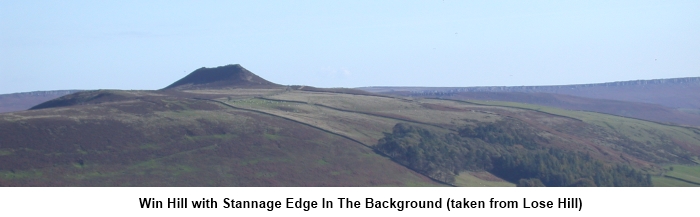
Climb this path until you can clearly see the unmistakable top Win Hill
Pike. On the map, the footpath continues to the edge of some trees at which
point you would turn left to Win Hill but in practice various tracks have
been worn. Use whichever takes your fancy and climb to the top (SK 187851).
Looking left (west) you will see the ridge curving away
from you in a clockwise direction. Follow the clear ridge path along (Thornhill
Brink and Hope Brink) until you reach a right hand turn which almost
immediately takes you into the trees (SK 173861). Follow the obvious
descending path which eventually branches
left until you reach the shore of Ladybower Reservoir.
Turn right and follow the
shore and past the dam. Just beyond, look out for a footpath on the right
signposted Thornhill (SK 198849).
[Note
since I walked this route, I am informed that another fingerpost has been
installed for the “Thornhill Trail”, before the one for “Thornhill”.
Do not be misdirected by this as I am informed it will take you on the wrong
route.]
Follow this
footpath. At the “cross roads” of paths, continue straight ahead. At the
metalled road, turn right then take the footpath almost immediately on your
left indicated by a fingerpost.
Remain on this footpath ignoring the branch to the left
until you come to another road (SK 186834). Cross straight over and follow
the path down towards the railway line. Join the road where it passes under
the railway and turn left . At the A6187, turn right into Hope.
If
you need to buy any hiking equipment/clothing before your trip see the Hiking
Store
All information on this
site is given in good faith and no liability is accepted in respect of any
damage, loss or injury which might result from acting on it.
|


.jpg)
.jpg)
.jpg)