|
Stanage
Edge
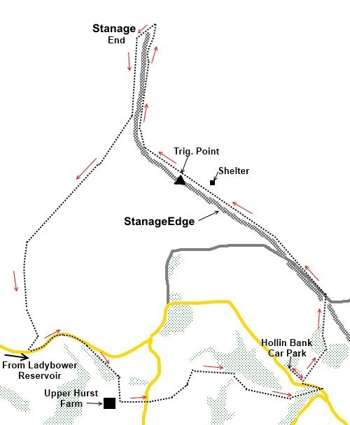
Starting point and OS Grid reference:

Hollin
Bank Car Park (SK238837)
|
Ordnance Survey Map
OL1
The Peak District – Dark Peak Area.
Buy this map from
List
of OS Maps
Note: If you use OS Maps on-line, you can download this route via this
link.
| |
Distance: 7 Miles
|
Date of Walk: 20 October 2010
| |
Ascent:
Descent:
See Walking Time Calculator
|
1098ft (335m)
1102ft (336m)
| |
Traffic
light rating: 

(For explanation see My
Walks page)
| |


For advice on .gpx files see
My Walks page
|

Click
the PDF logo above to give a printable version of this walk without the
photos.
|
To
view route as a dynamic Ordnance Survey map click here.
Introduction:
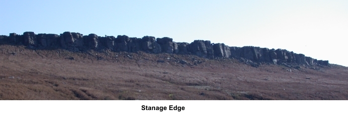
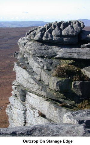
Stanage
Edge is a ridge of gritstone outcrop beloved of climbers stretching for
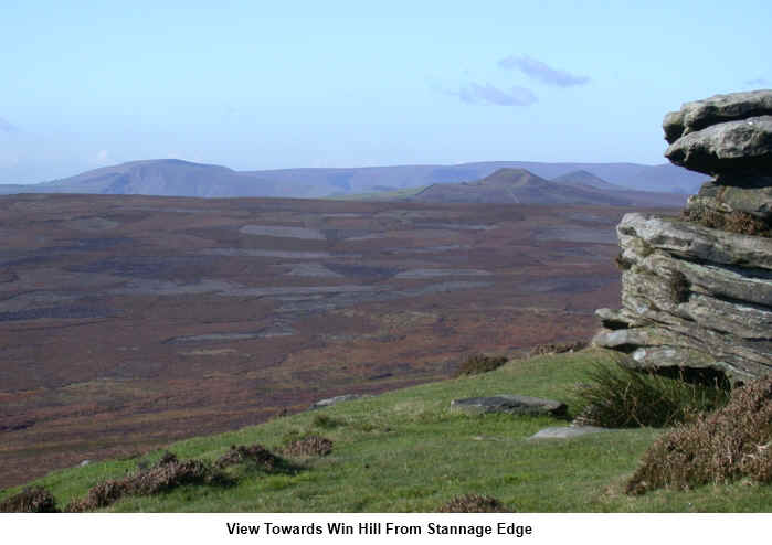
about 4 miles altogether. This walk along most of it gives spectacular views
of the Hope and Edale Valleys. It is an easy walk but it should be
remembered that this is an exposed ridge which will be hard hit by any
strong winds and rain so pick your conditions and be prepared!
To get
to the starting point of the walk, take the A6013 to Ladybower Reservoir. At
the south end of the reservoir is a narrow road opposite a telephone box
(SK202850) heading south east. The 1:25000 OS map shows it as New Road. Take
this road and ignore any turns off. Ignore the first car parking area you
come to at a sharp right hand bend and continue to a second car park on the
left at Hollin Bank. The patch immediately by the road is free. Start the
walk here (SK238837).
A small van selling great coffee, hot chocolate etc. is here most of the
time.
Start: Walk
parallel to the road in the car park in a south easterly direction until you
reach the end of the trees. Turn left and follow the obvious path towards
Stanage Edge which
will be clearly visible. After crossing a patch of open ground, you go
through some woodland. Walk up on to Stanage Edge itself (SK240844). Turn
left (NW) and follow the top of the ridge along. You will get the full
benefit of the magnificent views.
If
caught by bad weather or in need of somewhere to sit for lunch, there is a
shelter above High Neb (at SK231853). Continue
 along the Edge and as you
look below it, you will see another path on a closing trajectory. As they
meet, turn left on to this path.
along the Edge and as you
look below it, you will see another path on a closing trajectory. As they
meet, turn left on to this path.
Follow
the path for about 500 metres keeping a look-out for another path on the
right (SK224859). The main path appears to follow the line of the ridge not
least because climbers frequently use it but you do not want this, unless
there is a reason to drastically shorten the walk. The main path will lead
you back to the car park.
Having
taken the right turn, the path is quite clear at first but becomes rather
indistinct and is difficult to follow across the heather. It heads SW for
about 0.8 miles then turns south. You are heading for a disused quarry at
SK216840 where you join New Road along which you drove to begin the walk. On
reaching the road, turn left and follow the road as it climbs for 0.4 miles.
Look out
for a footpath on the right hand side (SK221839).
Follow
this path through the trees and as they peter out, look for a right turn on
to another footpath. Follow this path until you go through a gateway by
Upper Hurst Farm (SK223835) turn left here and follow the wall to the corner
of the field by some trees. Climb the stile into a field and cross this to
the road. Turn right and you will see a finger post pointing left, the
continuation of the route, along a broad farm track.
Follow
this track avoiding another footpath on the right until it descends into the
valley to
the beautifully situated Green House (SK229838). Pass between Green House
and other buildings, staying on the track.
The
track climbs past the ruins of an old mill and a pretty mill dam if you
climb the banking to have a look. Cross the stream and continue to climb. Do
not turn right to follow the stream. The path remains parallel with a copse
of trees briefly then passes through another copse and out on to the road.
Turn left and your starting point at the car park is just a couple of
hundred yards along, past the public toilets.
If
you need to buy any hiking equipment/clothing before your trip see the Hiking
Store
All information on this
site is given in good faith and no liability is accepted in respect of any
damage, loss or injury which might result from acting on it.
|


.jpg)
.jpg)
.jpg)