|
Upper
Barden Round With Rylstone Edge
Starting point and OS Grid reference:

Rough roadside parking (SE 038553)
|
Ordnance Survey Map
OL2
Yorkshire Dales Southern and Western Areas.
Buy
this map from
List
of OS Maps
Note: If you use OS Maps on-line, you can download this route via this
link.
| |
Distance: 11.5
miles
|
Date of Walk: 17 February 2015
| |
Ascent:
Descent:
See Walking Time Calculator
|
1249ft (381m)
1248ft (390m)
| |
Traffic
light rating: 
(For explanation see My
Walks page)
| |


For advice on .gpx files see
My Walks page
|

Click
the PDF logo above to give a printable version of this walk without the
photos.
|
To
view route as a dynamic Ordnance Survey map click here.
Introduction:
I
call this the Upper Barden Round simply to give it a title but it involves
following mostly very clear tracks used primarily for grouse shooting around
Burnsall and Thorpe Fell, Rylstone Fell and Embsay Moor. The area is part of
The Duke of Devonshire's estate. It is a marvellous walk in summer when the
heather is in bloom but watch out after the "Glorious 12th" once
the grouse shooting season starts as the area might suffer closures on odd
days. The shooting season ends on December 10th (apart from Northern
Ireland).
The walk
provides wonderful views in all directions which are especially dramatic
from the edge above Rylstone.
The walk
begins at an area of rough roadside parking (SE 038553). To get there, turn
west off the Bolton Abbey to Burnsall Road (B6160) where the road sign
indicates Eastby 2.5 miles and there is a brown tourist sign for the Embsay
Steam Railway. Cross a cattle grid and ignore the parking on the right just
beyond it. Round the next bend is a parking area on the left.
Please note there is no access for dogs on
Barden Moor as a result of one of 52 bylaws which were introduced by the
Yorkshire Dales National Park Authority when the 11th Duke of
Devonshire introduced open access on to Barden Moor in 1969. The 52
byelaws were introduced in the main for conservation purposes.
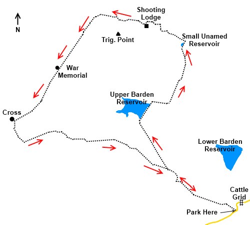
Start:
Opposite the
parking is where the walk starts and there is a finger post for Rylstone. On
reaching a broad track (SE033556),
turn left but note your position as it is quite difficult to spot this
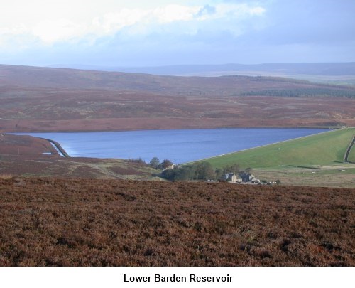
junction on the way back. Below you is Lower Barden Reservoir
Continue
along this track for about a mile until you reach a junction with a green
footpath (SE 021564) Turn right and when you join another track, turn
left. This track becomes fainter but soon joins a broader grass track.
Turn right and head for Upper Barden Reservoir which comes into view shortly
after going through two large stone gateposts (SE 014576).
Turn right
and cross the reservoir dam. Immediately after passing in front of the
house, leave the main track to the left at a finger post for Burnsall. You
stay on this broad track for about 1.25 miles then shortly after passing a
tiny reservoir turn left (SE 025595. As you approach this reservoir you will
see a stone shooting lodge on the horizon to your left where you are
heading.
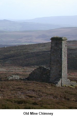
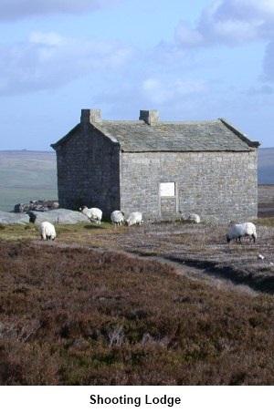
Turn left at
the next main junction of tracks and head towards the shooting lodge,
passing an old mine chimney on the left. Next to the shooting lodge is a
small building with some benches inside used by shooters. It is only secured
by a wooden gate and makes a convenient shelter for lunch in bad weather.
Please leave no litter behind. Alternatively, there are some large rocks by
the lodge.
Continue
along the broad track until you come to a stone wall at a corner (SE
000599). Turn left.
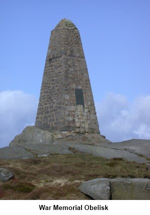
Follow the wall
until you come to a ladder stile which leads to the war memorial (SE
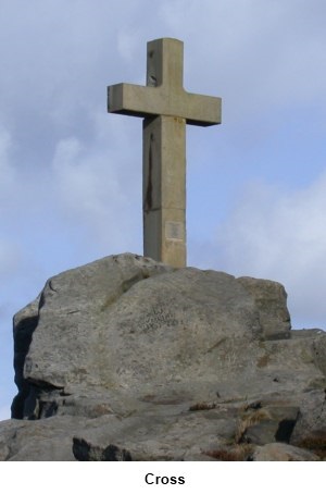
994588). Cross and admire the view across towards Malham. Climb back over the wall to follow the same footpath
and walk along Rylstone Edge until you reach the
cross (SD 982576). At the cross is another ladder stile for a closer look.
On the
eastern side of the wall, follow it downwards until it joins a broad track
coming through a gateway (SD 985571). Turn left.
At the
junction with the next track, turn left (SD 997571). At the next junction,
carry straight on signposted Halton Heights.
As the track
forks, take the right fork.
Stay on this
broad track and as you come in line with the end of the dam, watch out for
the path on the right where you came from the start of the walk. Take this
path back to the car park.
If
you need to buy any hiking equipment/clothing before your trip see the Hiking
Store
All information on this
site is given in good faith and no liability is accepted in respect of any
damage, loss or injury which might result from acting on it.
|


.jpg)
.jpg)
.jpg)