|
Further
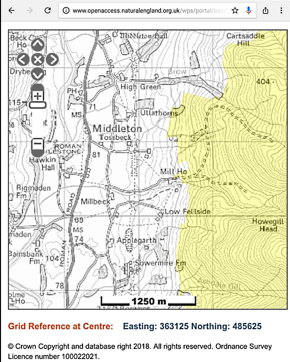
Information about the Access at Mill House
Additional research about the
access at Mill House has revealed the map below from the Natural England
website.
The yellow area is the Access
Land and it appears to show a connection with the solid lines of the road
and at least as far as the connection with the path to Low Felside, which is
the one used on my route.
All information on this
site is given in good faith and no liability is accepted in respect of any
damage, loss or injury which might result from acting on it.
|


.jpg)
.jpg)
.jpg)