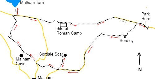
|
Bordley
to Malham Cove and Malham Tarn
Starting point and OS Grid reference: 
Parking
just beyond the cattle grid (SD 951653) at the end of Skirethorns/Malham
Moor Lane,
Threshfield
|
Ordnance Survey Map
OL2
Yorkshire Dales Southern and Western Areas.
Buy
this map from
List
of OS Maps
Note: If you use OS Maps on-line, you can download this route via this
link.
| |
Distance: 10.7
miles
|
Date of Walk: 2 January 2011
| |
Ascent:
Descent:
See Walking Time Calculator
|
1634ft (498m)
1654ft (504m)
| |
Traffic
light rating: 
(For explanation see My
Walks page)
| |


For advice on .gpx files see
My Walks page
|

Click
the PDF logo above to give a printable version of this walk without the
photos.
|
To
view route as a dynamic Ordnance Survey map click here.
This walk is now available
as a Kindle book. Click the symbol for further details

Introduction:
Although
over 10 miles, this is a relatively easy walk with just one section of
moderate ascent, to the well known amphitheatre of Malham Cove and Malham
Tarn. Some road walking is involved. The walk takes you through some classic
limestone scenery with a dramatic view of the cove from above and its famous
limestone pavement.
Arriving
at Threshfield (near Grassington) from the South, look out for Skirethorns
Lane on the left just after the filling station. Drive along here (keeping
right at the junction) for two and a half miles until you reach a cattle
grid. The metalled road runs out shortly after the cattle grid and it is
recommended you park on the rough ground just after the grid.
Start: The
walk begins by continuing along the road/track until you reach a gateway (SD
947655) indicating no through road for vehicles. Turn left here to Bordley,
indicated by a finger post. The track remains broad and clear and briefly
returns to tarmac status before arriving at the farming complex known as
Bordley.
Passing
in front of the farmhouse, the track bends round to the right and a finger
post indicates Malham. Pass through the gateway which appears on the left.
Remain on the clear track and ignore two paths which occur quickly to the
right.
The
track meets a stone wall on the left. Follow this wall. You pass a gateway
with a stile next to it but ignore these. Shortly after this stile, the
track becomes fainter and bears away slightly to the right heading for a
gateway. Continue through this gate on the broad obvious track.
At the
next farm (Lee Gate SD 927644) the track does zigzag through the farm
buildings or there is a gate on the right just before the descent to the
farm. A walled track cuts off the bends, coming out below the farm at a three
finger signpost.
Continue
straight ahead and you are quickly on the metalled road which leads to
Malham. Descend this for about one and a quarter miles until you reach an
obvious and signed track on the right into the gorge at Gordale Scar (SD
913635).
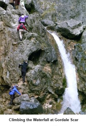
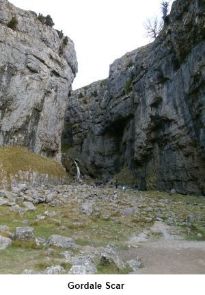
It is worth following this path to see the gorge and the waterfall
which flows at its end (about a third of a mile). As you can see from the
picture, it is possible to climb up by the waterfall on another footpath
which will take you to Malham Tarn although great care needs to be taken if
the waterfall is in full flow or if it is icy but our route involves
retracing the path to the road.
You
will immediately see a prominent lay-by on the right from which runs a
footpath at a kissing gate which
is your route to Malham Cove. At the next road, cross slightly right over a
stile. The path appears to split but both routes come together again after a
short distance.
Follow
the wall on your left and where it turns left on a right angle, continue to
follow it. It expires and becomes a fence. Follow this very carefully to the
precipice (be very careful as it is a long drop!) from where there is a
dramatic view of Malham Cove from above (SD 898641). Most people only see it
from below.
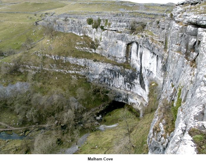
 After
enjoying the view, retrace your steps to the main path and turn left
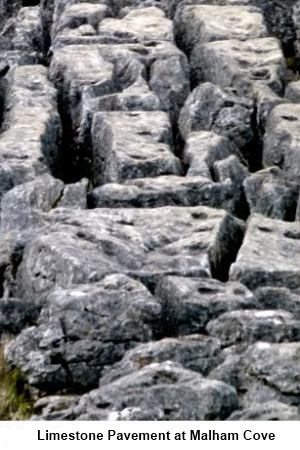
parallel with the limestone cliff you have just left. You will soon be
overlooking the limestone pavement with its “clints” (limestone blocks)
and “grikes” (fissures). Below you is a wall and stile. Cross over the
stile. The route turns right but the limestone pavement provides good
opportunities to have lunch looking down the valley but take care if
approaching the edge. Note also that limestone gets very slippery if wet.
After
enjoying the view, retrace your steps to the main path and turn left
parallel with the limestone cliff you have just left. You will soon be
overlooking the limestone pavement with its “clints” (limestone blocks)
and “grikes” (fissures). Below you is a wall and stile. Cross over the
stile. The route turns right but the limestone pavement provides good
opportunities to have lunch looking down the valley but take care if
approaching the edge. Note also that limestone gets very slippery if wet.
Follow
the wall along the gorge, part of the Pennine Way. After a short ascent,
over a stile (SD 891649), turn right to Malham Tarn as indicated by the
finger post.
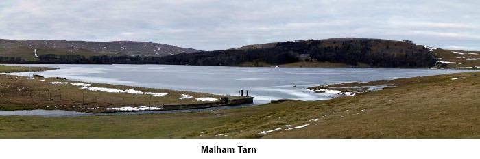
On
reaching the road (SD 893658), turn right. To catch sight of Malham Tarn,
you need to branch off to the left for a quarter of a mile at the finger
post by the small car park. Malham Tarn was created originally by
glaciers (although has been dammed to increase its size) and is the highest
lake in England. It is a wetland haven for wildlife and birds.
Return
to the road and turn left. Continue until it bends sharply right (signed for
Malham 2 miles) but you go straight ahead to a gate in a stone wall ahead
(SD 905656). A sign on the gate reads Street Gate to Arncliffe Cote. Pass
through the gate and stay on the broad track with the wall on your right.
This is Mastiles Lane and you should remain on this ignoring any turns off.
You cross a stone clapper bridge (SD 911656).
The
track passes the site of the Mastiles Roman camp which is indicated by an
information board. Eventually at a gate, the walled track reverts to a
footpath. Bear right following the signs for Threshfield which will take you
back to your car.
If
you need to buy any hiking equipment/clothing before your trip see the Hiking
Store
All information on this
site is given in good faith and no liability is accepted in respect of any
damage, loss or injury which might result from acting on it.
|


.jpg)
.jpg)
.jpg)