|
Barden
Bridge to Simons Seat
Starting point and OS Grid reference:

Barden
Bridge (SE 053574) – Limited parking by bridge
|
Ordnance Survey Map
OL2
Yorkshire Dales Southern and Western Areas.
Buy
this map from
List
of OS Maps
Note: If you use OS Maps on-line, you can download this route via this
link.
| |
Distance: 8.5
miles
|
Date of Walk: N/K
| |
Ascent:
Descent:
See Walking Time Calculator
|
482m (1580ft)
481m (1580ft)
| |
Traffic
light rating: 

(For explanation see My
Walks page)
| |


For advice on .gpx files see
My Walks page
|

Click
the PDF logo above to give a printable version of this walk without the
photos.
|
To
view route as a dynamic Ordnance Survey map click here.
Introduction:
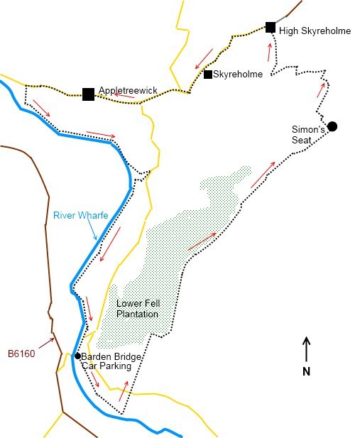
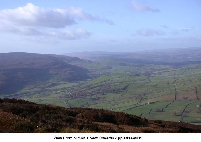
This walk
takes you through part of the Bolton Abbey Estate, to the great vantage
point of Simon’s Seat with views over Upper Wharfedale and to the
picturesque village of Appletreewick where two good pubs give an opportunity
for refreshment before returning by a riverside footpath by the River Wharfe.
Start the
walk at Barden Bridge (SE 053574). To get there, head for Bolton Abbey and
from here head north on the B6160 and take the next sharp right turn
signposted Appletreewick, just by Barden Tower. Parking is just over the
bridge on the left and is very
limited so get here early especially at weekends. There is sometimes paid
parking here on the Bolton Abbey Estate at peak times in summer.
Please
note, there is no access for dogs on Barden Fell as a result of one of 52
bylaws which were introduced by the Yorkshire Dales National Park Authority
when the 11th Duke of Devonshire introduced open access on to
Barden Fell in 1969. The 52 byelaws were introduced in the main for
conservation purposes.
Start: Walk through
the gate next to the bridge (next to the Bolton Abbey Estate parking
attendant’s booth). Follow the course of the river as far as the viaduct
and turn left here (SE 057568). The
path climbs steadily to the road and continues beyond it. Stay on this path
as far as the trees. It then turns right to follow the line of the wall
around the trees.
Follow the
wall until you reach a steeply descending broad track on the left (SE
069589). Ignore this track and continue to follow the line of the wall for
about 400 yards. The path now veers right to Simons’s Seat and becomes
flagged.
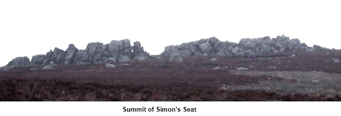
You reach the
jumble of stones which is Simon’s Seat with its trig. point (485 metres)
after about half a mile.
After
stopping to admire the view, pass straight through the area of the stones in
a north easterly direction and follow the zigzag path down to a stile near
Dalehead Farm. Turn left along the farm track and watch out for a footpath
on the right (signed) heading north to High Skyreholme. It emerges between
buildings on to the metalled road. Turn left, past the entrance to Parcevall
Hall and left at the next road junction.
At the next
road junction, keep straight ahead to Appletreewick.
The route
passes through the village and after passing the Craven Arms, take a
footpath to the left alongside a campsite. This takes you to the River
Wharfe and you follow its left bank all the way back to Barden Bridge.
If
you need to buy any hiking equipment/clothing before your trip see the Hiking
Store
All information on this
site is given in good faith and no liability is accepted in respect of any
damage, loss or injury which might result from acting on it.
|


.jpg)
.jpg)
.jpg)