|
Laycock,
Gooseye and Keighley Moor (returning to Laycock)
Starting point and OS Grid reference:

Laycock (SE 032409) - street parking
|
Ordnance Survey Map
OL21 - South Pennines.
Buy this map from
List
of OS Maps
Note: If you use OS Maps on-line, you can download this route via this
link.
| |
Distance:
7.5 miles
|
Date of Walk:
19 November 2010
| |
Ascent:
Descent:
See Walking Time Calculator
|
1247ft (380m)
1259ft (384m)
| |
Traffic
light rating: 
(For explanation see My
Walks page)
| |


For advice on .gpx files see
My Walks page
|

Click
the PDF logo above to give a printable version of this walk without the
photos.
|
To
view route as a dynamic Ordnance Survey map click here.
Introduction: This walk over the no-mans land between
Yorkshire and Lancashire starts in the hamlet of Laycock near Keighley (SE
032409). There is parking available outside the memorial hall where the road
is wider.
Start: Walk west along the main street and turn left
down Robert Street. This is a short street at the end of which is a narrow
walled flagged footpath which takes you through to a road. At the road, turn
left down the steep hill to
Goose Eye, an attractive little hamlet with a good pub, The Turkey, where
you can enjoy refreshment on your return.
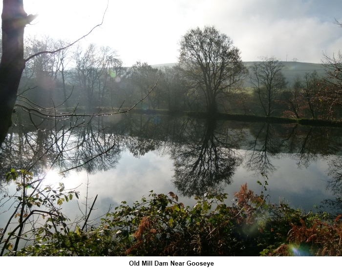
Walk through the hamlet past the pub and
about 100 yards further on look out for a footpath on the right by the beck.
Follow the beck along Newsholme Dean past the old mill dam. At a fork turn
right and follow the footpath past the back of a farmhouse and climb uphill
to a road (SE 013410).
Turn left and almost immediately, left again
on to another footpath following the Millennium Way down
to Slippery Ford (SE 005406). Take care crossing the stream via any
available stones, especially after heavy rain.
A short walk alongside the beck then signs then
directed you right to a farm (Slitheroford Farm) where you go through the
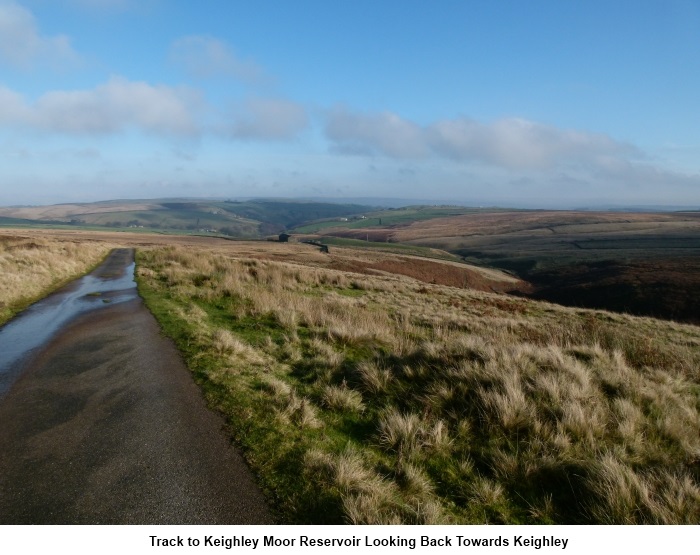
farmyard on to the road (SE 002406). Turn left and there is not far to go
before a Yorkshire Water metalled track on the right takes you uphill to
Keighley Moor Reservoir, the highest point of the walk.
Cross the dam and at its end, ignore a track
to the right but look out for a concrete post on the left. This marks a
footpath which is your route across the moors. The path is a little
indistinct at first but then it joins a wall on the left. Follow the wall
for about 150 yards then turn left through a gateway/opening in the wall.(SD
995388) to follow a narrow path across the moor.
At a
wide stony track at a cattle grid turn right (SE 003392) A stone nameplate
in the wall indicates that track behind you leads to Clough Hey.
The track becomes metalled after a while. At
the road proper, continue straight across on to a wide track and follow this
to the hamlet of Newsome. You pass the impressive Church Farm on the right built
in 1671 and which actually contains a church. Continue
along the road and take a left turn opposite Green End Farm. This track
leads to a road where a left turn will return you to the Turkey at Goose
Eye.
Follow your outward route back to Laycock.
If
you need to buy any hiking equipment/clothing before your trip see the Hiking
Store
All information on this
site is given in good faith and no liability is accepted in respect of any
damage, loss or injury which might result from acting on it.
|


.jpg)
.jpg)
.jpg)