|
Use Of GPS Receivers
GPS stands for
Global Positioning System. They work on the same basis as satellite
navigation in cars in that they receive signals from satellites orbiting the
earth. At any one time, they receive from up to 6. The satellites
belong to the American military.
From these
signals, a GPS receiver can calculate where it is horizontally and if
sufficient signals are received, they also give your altitude.
Once your route
is entered, you simply follow the arrow or simple map screen.
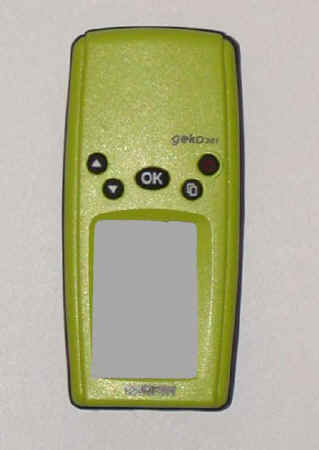
Some of the
best known are produced by Garmin and their former basic model, the Geko, which I
have used for years, is shown in the
picture below. It is about the size of a mobile phone and cost me about £80
from Amazon. With greater expense, you can now get
sophisticated receivers which include built in
OS maps. Some mobile phones now offer a GPS facility.
 Further
information a GPS instrument may provide is: Further
information a GPS instrument may provide is:
* Current Location;
* Altitude;
* A
"breadcrumb" trail of where you have walked -with which
you can retrace your steps if necessary;
* Waypoints;
* Trip time;
* ETA;
* Distance
walked;
* Speed;
* Very
accurate time (atomic clock);
There are also
various other features depending on which model you get. Some of the more
advanced (and consequently expensive) models even have OS maps built in
viewable on screen.
The Garmin Geko has now been
superceded by the eTrex.
They come with comprehensive instructions and there is not the space or necessity
to repeat everything here. However one or two points.
They can be
configured to provide your location in a variety of formats depending on
where in the world you are. In the UK, you would set it to give OS
references.
If you use them for nothing else,
they are a boon if you are lost and will tell you to within feet exactly where you are by means of
a full OS Reference , e.g. SD 95034 62711. You can then relate this to your
map, rounding the reference to SD 950627.
GPS receivers are not always reliable
under heavy tree cover and need to have an open view of the sky. If navigating your way
through a forest in the absence of clear paths, you may need to use a compass.
To get the best use from a GPS
receiver, you really need some mapping software for your computer. These
enable the route to be plotted on an on-screen map then downloaded to the
GPS receiver. The software is however quite expensive. The best known names
in this field are probably Memory Map and Anquet.
There is also a free GPS
software package available from GPS Utility.
This works well but you have to scan your own maps then calibrate the
scanned map carefully to
ensure the OS reference points are where they should be.
An alternative to your own
software is an amazing website Where's
The Path. Here, you can upload a GPX file and see the route on a 1:25000
OS map side by side with the equivalent Google satellite photo. You can also
plot your own routes.
Another site where you can plot
your own routes then download them in GPX and other formats is bike.co.uk
To download routes from your PC
to a GPS receiver, see EasyGPS.
Routes for walks described on
this site can be downloaded to GPS receivers using either MMNav (Memory Map)
or .gpx (universal GPS
Exchange Format) files.
To view GPS receivers at competitive prices
click here → GPS
Receivers
Visit the Happy Hiker (in
Association with Amazon) on line Hiking
Store to buy mapping software.
All information on this
site is given in good faith and no liability is accepted in respect of any
damage, loss or injury which might result from acting on it.
|


.jpg)
.jpg)
.jpg)