|
Three
Men of Gragareth
Starting point and OS Grid reference:

Roadside lay-by ( SD691757)
|
Ordnance Survey Map
OL2
Yorkshire Dales Southern and Western Areas.
Buy
this map from
List
of OS Maps
Note: If you use OS Maps on-line, you can download this route via this
link.
| |
Distance: 7.7miles
|
Date of Walk: 10 November 2010
| |
Ascent:
Descent:
See Walking Time Calculator
|
498m (1632ft)
498m (1633ft)
| |
Traffic
light rating: 

(For explanation see My
Walks page)
| |


For advice on .gpx files see
My Walks page
|

Click
the PDF logo above to give a printable version of this walk without the
photos.
|
To
view route as a dynamic Ordnance Survey map click here.
Introduction:
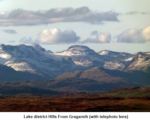
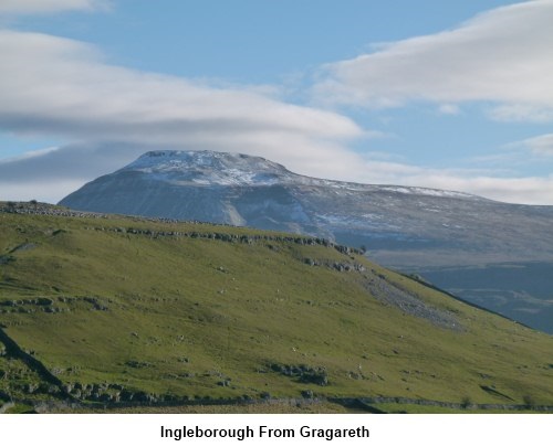
This
walk is a little unusual in that it follows no public footpaths marked on
the OS map but it provides the most rewarding views of Ingleborough, The
Lake District and Morecambe Bay. It is mostly a straightforward walk but
there is one very steep section. It is not very long and does not get quite
to the scrambling stage.
Start: Turn off
the A65 near Ingleton into the hamlet of Thornton-in-Lonsdale. In the centre
of the hamlet, take the road to Dent. After passing a road junction on the
left, continue for a further 0.4 miles. There is a lay-by on the left. Park
here and the route starts from the gate next to the lay-by (SD691757).
Follow
the gently rising, winding but obvious path until it meets a wall at a broad
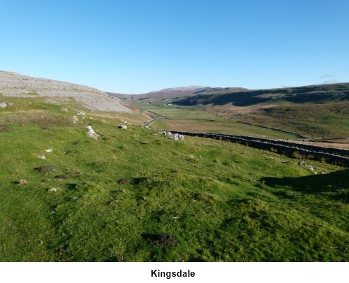
stony track (SD 685768). This track is called Turbary Road on the OS map.
Turn right (NE).
Continue
along this track through 6 gates. Just after the sixth gate, the track bears
slightly left on a northern heading and begins to rise slightly. At the next
gateway (SD710790), turn sharply left and follow the right hand (northern)
side of the wall (important). The path is not especially clear but you will
see where others have walked as you ascend. You will see the steepest part
of the walk ahead of you. Do not be daunted. Just take it steady.
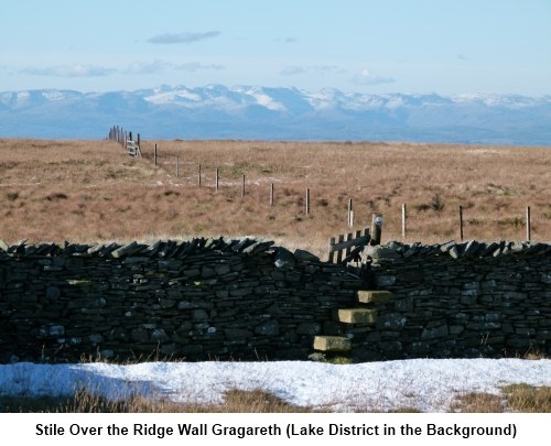
Go over
the stile in the stone wall at the top of the ridge (SD791796) and turn left
to follow the wall for a short distance. Keep a look out on the right and
you will see the concrete trig. point (SD 688793).
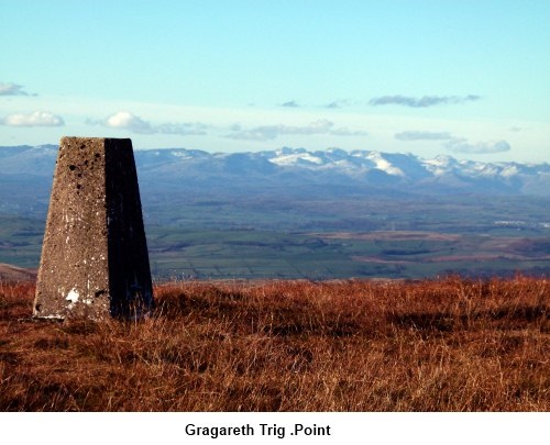
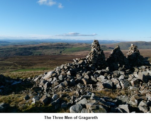
From the trig. point,
take the most prominent path in a westerly direction and you will soon see
the large stone cairns. Although marked on the map as the Three Men of
Gragareth, there actually seem to be 6 of them in two groups of three. Their
history is unknown.
The
path from the cairns is indistinct but essentially, remain at the same level
and follow the contour of the land curving in a southerly direction until
you reach a wall. Depending on exactly where you hit this wall, you may have
to climb it but turn left and follow it until it intersects another wall at
90 degrees. This wall follows the line of the ridge and you should turn
right and follow it for a short distance until you reach a gateway. Pass
through the gateway. The path the appears to follow the wall and it is in
order to follow the wall for a while in a south westerly direction.
However, as the slope lessens, you need to head to the left in
a more southerly direction. If you reach a boggy section, you have gone too
far! Follow the wall ahead of you until you see a stile (SD677772).
Over
this stile and follow the obvious track in a SE direction until you reach
another stile. (SD679766). Over this stile and you are on a broad stony
track which becomes Turbary Road. Turn left and continue along this track.
Pick up a small stone (see next paragraph).
The
track soon approaches the corner
of two walls and passing this corner confirms you have not turned off too
soon. You are looking for a grassy track on the right which can sometimes be
easy to miss especially if you are deep in conversation and you need to
concentrate here. About 100 yards beyond the corner of the wall, the track
dips very slightly then rises again. These changes are very slight but
important because at the bottom of the dip is the right turn for your route,
on to a grassy track (SD 685768). A small cairn has been started and if you
add the stone you have picked up earlier, you will help make the track more
obvious for others!
The return to the lay-by then retraces
the same route which you used to start the walk.
If
you need to buy any hiking equipment/clothing before your trip see the Hiking
Store
All information on this
site is given in good faith and no liability is accepted in respect of any
damage, loss or injury which might result from acting on it.
|


.jpg)
.jpg)
.jpg)