|
Pen-Y-Ghent
and Plover Hill
Starting point and OS Grid reference: 
Car
park in Horton-in-Ribblesdale (SD 808726)
|
Ordnance Survey Map
OL2
Yorkshire Dales Southern and Western Areas.
Buy
this map from
List
of OS Maps
Note: If you use OS Maps on-line, you can download this route via this
link.
| |
Distance: 8.45
miles
|
Date of Walk: 14 November 2007
| |
Ascent:
Descent:
See Walking Time Calculator
|
555m (1821ft)
555m (1820ft)
| |
Traffic
light rating: 


(For explanation see My
Walks page)
| |


For advice on .gpx files see
My Walks page
|

Click
the PDF logo above to give a printable version of this walk without the
photos.
|
To
view route as a dynamic Ordnance Survey map click here.
Introduction:
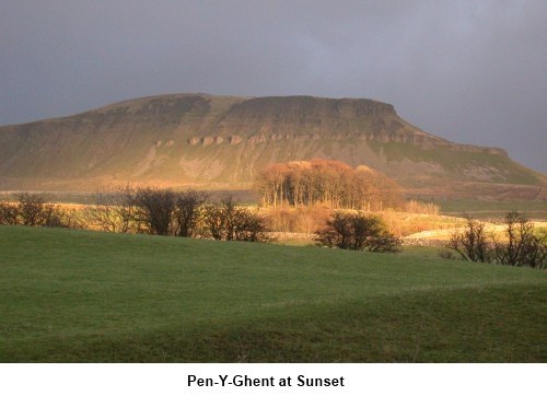
There is
something about Pen-y-Ghent, one of the summits to be conquered during the
famous “Three Peaks” walk – the others being Ingleborough and
Whernside. It has an unmistakable majesty and profile all of its own. A
bonus is that if you do the walk at the end of March/beginning of April at
about 1900 feet on the limestone cliffs you may be lucky enough to see the
rare purple saxifrage, which was left over from the last ice age.
The walk is
pretty straightforward and large sections of the path have been 'manicured'
with large stones and on the summit with stone flags. I can see these
reinforcements are a necessity but take care if conditions are icy, as the
ice can make for very tricky walking on them. There is one short section of
scrambling where you will need to use your hands. Again, take great care if
it is icy.
I recommend
undertaking this walk in the direction shown (i.e. anti clockwise) as the
scramble is much safer going up than down.
The walk starts at the main car park close to
the Crown Inn on the B 6479 at Horton-in-Ribblesdale (SD 808726).
Alternatively, you can park at the Golden Lion Hotel at more modest cost. To
get there, take the signposted turn off by the river bridge in Settle.
Horton is also accessible via train from the Settle Carlisle route.
At peak times you will find Horton very busy
because Horton is the starting point where many entrants “clock in” for
the Three Peaks Challenge.
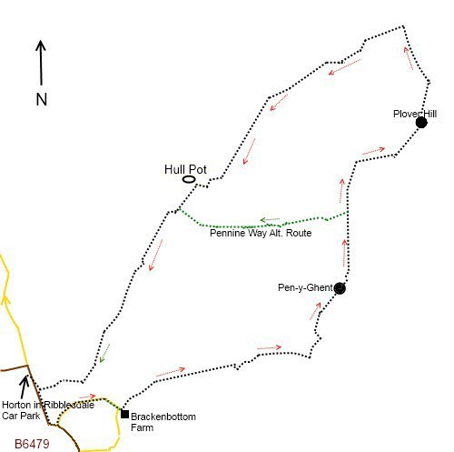
Start: Out of the
car park, turn right and walk through the village on the B6479 and round the
right-angled bend by the church. Ignore the first on the left (where the
post box is) and take the second left which is School Lane. Follow this
round until you get to a barn on the left at Brackenbottom Farm and a finger
post on the left signed “Pennine Way” (SD 818722). Pass through the gate and the
small walkers' gate.
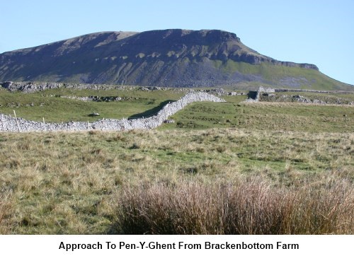
The well worn
and now largely 'manicured' route then follows the line of the stone wall on your left.
You reach the ridge just below the
“nose” of Pen-y-Ghent at a ‘T’ junction of paths (SD 836728). Turn left.
#
If you are picking this walk up as a continuation of my Horton
in Ribblesdale to Helwith Bridge and Great Moor Head walk, this is where
they intersect.
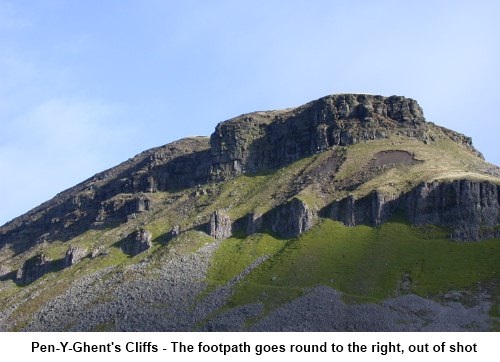
The walk now
earns its red traffic light with a vengeance. A very steep climb, keeping
the wall to your left and where
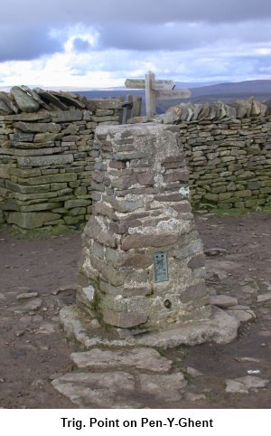
you may need to use your hands now and again, takes you to the summit (SD 839734). Here
you will find the trig point and an unusual ‘S’ shaped shelter with
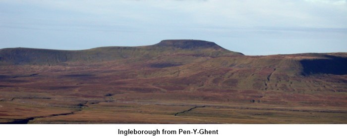
stone seating built into the wall. There are magnificent views east towards
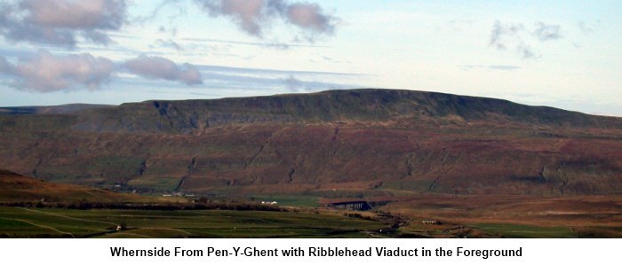
Littondale, west towards Ingleborough and north-west towards Whernside.
 Climb the
ladder stile to the west side of the wall. If for any reason you want to
shorten the walk, the Pennine Way straight ahead and indicated by a finger
post will take you back to Horton-in-Ribblesdale.
Otherwise, turn right following the wall to the summit of Plover Hill. The
wall you have been following meets another at a ‘T’ (SD 748752). Cross this wall and
the path then kinks slightly right before a steepish grassy descent across
Foxup Moor to a broad track (SD 846762). Turn left. Climb the
ladder stile to the west side of the wall. If for any reason you want to
shorten the walk, the Pennine Way straight ahead and indicated by a finger
post will take you back to Horton-in-Ribblesdale.
Otherwise, turn right following the wall to the summit of Plover Hill. The
wall you have been following meets another at a ‘T’ (SD 748752). Cross this wall and
the path then kinks slightly right before a steepish grassy descent across
Foxup Moor to a broad track (SD 846762). Turn left.
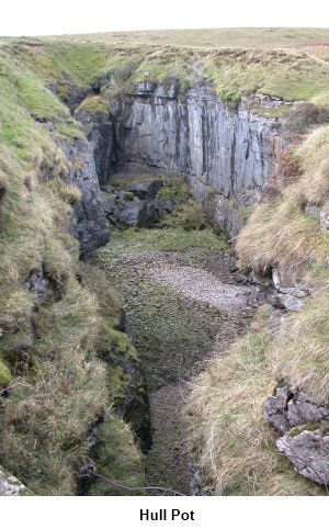
Basically
this track now takes you straight back to Horton but there is an interesting
feature to look out for about 1.75 miles after you join the track. This is
Hull Pot on the right about 200 feet from the track (SD 825746).
The
track emerges in Horton close to the car park. Ignore any left or right
turns on the way.
If
you need to buy any hiking equipment/clothing before your trip see the Hiking
Store
All information on this
site is given in good faith and no liability is accepted in respect of any
damage, loss or injury which might result from acting on it.
|


.jpg)
.jpg)
.jpg)