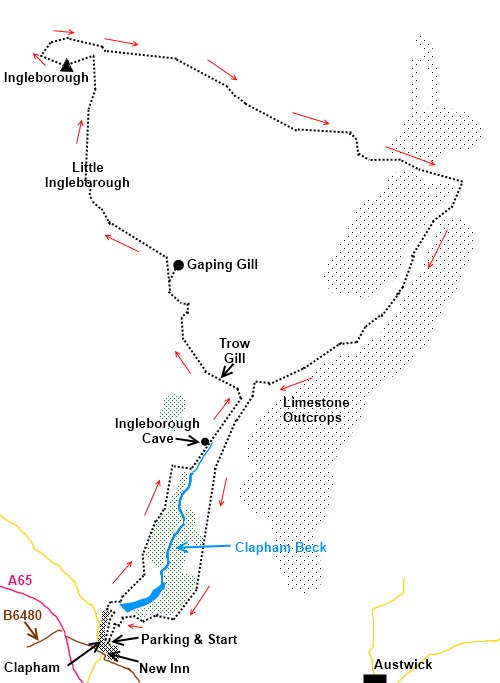
|
Ingleborough
From Clapham
Starting point and OS Grid reference:

Clapham
Village Car Park (SD 745692)
|
Ordnance Survey Map
OL2
Yorkshire Dales - Southern and Western Areas.
Buy
this map from
List
of OS Maps
Note: If you use OS Maps on-line, you can download this route via this
link.
| |
Distance: 11.2
miles
|
Date of Walk: 19 June 2006
| |
Ascent:
Descent:
See Walking Time Calculator
|
733m (2405ft)
732m (2403ft)
| |
Traffic
light rating: 


(For explanation see My
Walks page)
| |


For advice on .gpx files see
My Walks page
|

Click
the PDF logo above to give a printable version of this walk without the
photos.
|
To
view route as a dynamic Ordnance Survey map click here.
This walk is now available as a Kindle book.
Click the symbol for further details

Introduction:
There are a
number of different ways to climb Ingleborough but this is the best and
takes in its most interesting features Ingleborough Cave, Trow Gill, Gaping
Gill, Ingleborough itself, the limestone outcrops at Sulber Nick and the
magnificent limestone of Moughton Scar. One point to bear in mind is that
Ingleborough frequently has a cap of cloud. The top of Ingleborough is a
strangely disorientating place in cloud/mist and you are strongly urged to
take a compass with you just in case.
The
walk starts in the village of Clapham where on street parking is limited but
there is a car park. To get to Clapham, approach
on the A65 from whichever direction and turn off to the north east side on
the B6480. From the NW, turn left as you face the New Inn or from the SE,
turn right when you get to it.
An
alternative route up Ingleborough is Ingleborough
from Ingleton.
Start: Cross the
beck by the footbridge and turn right along Riverside and left at the sharp
bend at the top on to Old Road (SD 746695) A short distance along here, look
out for a finger post signed Ingleborough Cave, Gaping Gill and Ingleborough
and take this track. At the end of some trees, the track forks and you take
the right hand fork with Clapdale wood on your right. The track forks again,
the left fork being a walled lane but you want the right fork again to
Clapdale Farm.
 Through the
farm (SD 751709), turn right until you join the main track Clapdale Drive
close to Clapham Beck and turn left. Follow this track and you will come to
Ingleborough Cave. If you wish to see the cave (open February to October),
there is a charge. It has been showing tourists round for over 170 years.
Through the
farm (SD 751709), turn right until you join the main track Clapdale Drive
close to Clapham Beck and turn left. Follow this track and you will come to
Ingleborough Cave. If you wish to see the cave (open February to October),
there is a charge. It has been showing tourists round for over 170 years.
Stay on the
main track for about 0.3 of a mile at which point the track turns sharply left (SD 758715).
Go through a gate (or over the stone step stile beside) and proceed ahead to
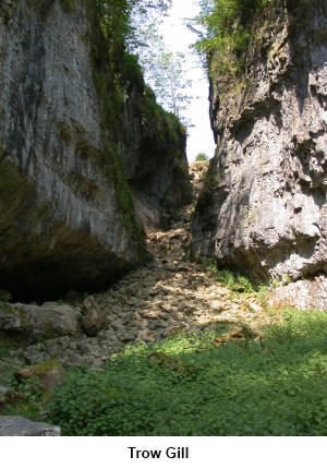
the
dramatic limestone gorge of Trow
Gill. The path goes through the Gill and there is a short easy scramble at
the end, at which point you get the first views of Ingleborough itself.
Once out of
the Gill, the path follows the line of a wall then over a double stile and
on to the open fell. Stay on the main rising track until it forks (SD
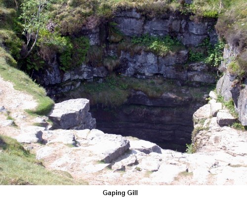
751725). Here to the right is a worthwhile diversion to Gaping Gill. Fell
Beck drops into the abyss. Be sure you do not do the same! It plunges down
for 100 metres. At certain times of the year, notably spring Bank Holiday,
the Bradford Pothole Club set up a winch to lower the public down. There is
a charge.
Having
cautiously inspected Gaping Gill, return to the main track (there is a path
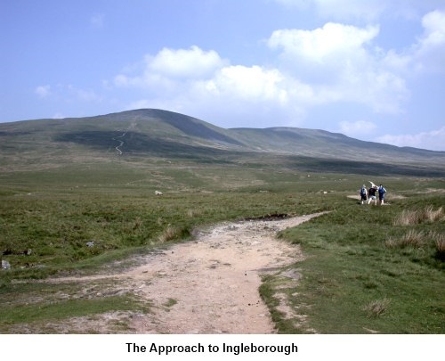
which cuts the corner off) and turn right. Now begins the steep part of the
walk first up Little Ingleborough then Ingleborough itself. As you reach the
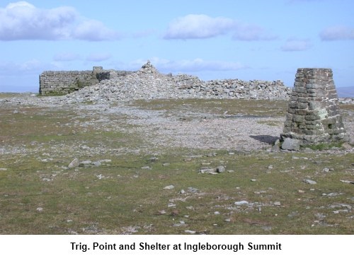
edge of the summit plateau (SD 744747), turn left (SW) to reach the trig.
point and cross shaped shelter (SD 741746).
From
here, rather than heading straight back to the track, if it is a clear day,
it is worth heading roughly NW to the edge of the plateau (in effect
continuing in the same direction at which you approached the shelter) and
turn right following it along to marvel at the view. You will rejoin the main path at SD 745747.
If
it is foggy do not do this but set your compass from the trig. point (set
the bezel on the compass to 70° and follow the direction arrow - see my Finding
Your Way page for advice on using the compass if you are in doubt) to
return to the point where you joined the plateau. Turn left to get to SD
745747 – only about another 100 yards.
Look out for
the footpath descending in a NE direction and where it forks when descending
a cobbled section, take the right fork in a just south of easterly
direction, heading towards Pen-y-Ghent. After almost a mile, cross a wall
via a double stile, the track gradually converges on a wall from the left.
Follow it along past the remains of an old shooting lodge (SD 767740).
You go
through a gate at the next wall and the path soon forks. Take the left fork.
The path narrows as it passes between boulders and the wall. Go through
another gate. At a 4 way finger post (SD 778735) signed Pennine Bridleway
and Clapham 3.5 miles, turn right. Follow the path to a gate in a wall and
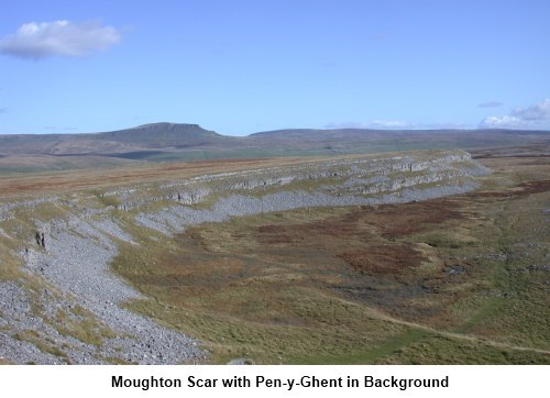
as you pass through this, look to your left through another gate to see Moughton Scar which is actually quite something.
Continue
along the track and go right at the next
fork (SD 772725). At the next fork (SD 768720) go right again. The path just misses the right angle corner of two
walls (SD 763718) and then goes through a gate. You should now see the trees
lining Trow Gill at the other side of the valley.
Continue
descending on the obvious track down the left (SE) side of the Clapham Beck
valley. It becomes a walled lane. At the junction of walled lanes at the
cormer of a wooded area, turn right. The lane leads back to Clapham through
two tunnels. A
refreshing pint can be had at the New Inn!
If
you need to buy any hiking equipment/clothing before your trip see the Hiking
Store
All information on this
site is given in good faith and no liability is accepted in respect of any
damage, loss or injury which might result from acting on it.
|


.jpg)
.jpg)
.jpg)