|
Hetton
to Winterburn Reservoir
Starting point and OS Grid reference:

Hetton
Village (SD 926589) – on street parking.
|
Ordnance Survey Map
OL2
Yorkshire Dales – Southern and Western area.
Buy
this map from
List
of OS Maps
Note: If you use OS Maps on-line, you can download this route via this
link.
| |
Distance: 8 miles
|
Date of Walk: 23 November 2012
| |
Ascent:
Descent:
See Walking Time Calculator
|
888ft (271m)
891ft (272m)
| |
Traffic
light rating:

(For explanation see My
Walks page)
| |


For advice on .gpx files see
My Walks page
|

Click
the PDF logo above to give a printable version of this walk without the
photos.
|
To
view route as a dynamic Ordnance Survey map click here.
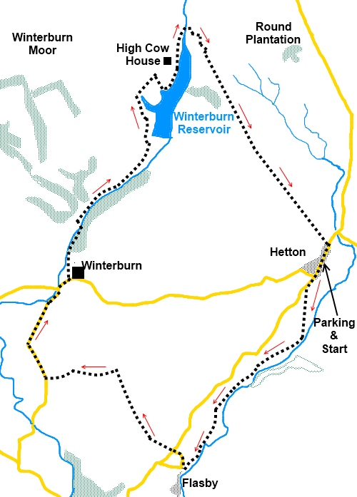
Introduction:
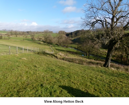
This easy 8 mile walk from Hetton
starts off following Hetton and Flasby Becks to the tiny hamlet of Flasby,
then curves round to follow Winterburn Beck and Winterburn Reservoir before
returning to Hetton.
Hetton is a pretty Yorkshire Dales village
whose main claim to fame is probably the Angel Inn, from where the walk
starts. This pub is renowned for its quality food.
To get to Hetton, either turn north off the
A65 in Gargrave or west off the B6265 Skipton to Grassington road at
Rylstone (of Calendar Girls fame).
Parking at Hetton is on street.
Start:
With your back to the Angel Inn, turn right and walk along its main street.
At the road junction, take the left fork, following the road sign for
Gargrave and Settle. Just after passing the national speed limit sign on the
outskirts of the village, take the footpath across the fields off to the
left indicated by a fingerpost to Flasby (SD
960586). Follow the direction of the arrow across a couple of fields until
you reach the beck and turn right.
%20View%20towards%20Flasby%20Fell.jpg)
The route of the path is fairly clear and it
more or less follows the beck to the outskirts of Flasby. Here just in front
of a farm, go through a gate on to a tarmac lane and turn right (SD 947566).
Follow this lane as it bends right behind the farm and at the road junction,
go straight across and follow the footpath sign next to Flasby Top Cottage
for “Winterburn 1½ miles”.
The path starts off to the right of the field
wall. After about 100 yards, look out for a short length of wall on the
right and shortly after this, the footpath switches to the left hand side of
the wall.
%20Looking%20towards%20Rylstone%20and%20Cracoe%20Fells.jpg)
The path goes over a gated stile into a large
field where there is a wood over to the left. Head for the top right hand
corner of this field. At the corner (SD 940577), stay in the same field but
turn left to follow the fingerpost for Friars Head. At the field corner, go
through the gateway then bear off right at 45° and head for the far corner
of the next field. Turn left here and follow the wall to the road (SD
932576). Turn right here.
Follow the road for ¾ mile to Winterburn
Hall, ignoring the road junction to the left over a bridge to Airton and
Malham. At Winterburn Hall (about 150 yards after the road to Airton/Malham),
turn left along the no through road, by the “Winterburn” sign (SD
935586).
This is the access road to the reservoir and
you follow this to the dam passing through the grounds of Winterburn Wood
farm, following the fingerpost for “Waygill 1 mile”.
Stay on the access road until you reach the
drive to High Cow House. Here, turn right to cross a stone stile
(SD 944608). A notice tells you that the footpath was legally diverted in
1990. The path leads to the reservoir water’s edge where you turn left to
follow the shore.
%20Winterburn%20Reservoir.jpg)
After passing through a walkers’ gate by
some trees, there is a very handy bench for lunch up the short hill on the
left.
%20End%20of%20Winterburn%20Reservoir.jpg)
Follow the water’s edge footpath and at the
end of the reservoir, turn right over the bridge and follow the footpath up
the hill. At the top, go through the gate straight ahead and follow the
walled, broad bridleway south east back to Hetton. Ignore any tracks off.
%20Winterburn%20Reservoir%20and%20Pendle%20hill.jpg)
%20Bridleway%20to%20Hetton.jpg)
At the road, turn right to return to your
starting point.
If you need to buy any
hiking equipment/clothing before your trip see the Hiking
Store
All information on this
site is given in good faith and no liability is accepted in respect of any
damage, loss or injury which might result from acting on it.
|


.jpg)
.jpg)
.jpg)