|
Burnsall
to Grassington
Starting point and OS Grid reference:

Burnsall
SE 032611 – Limited road parking plus pay and display cp.
|
Ordnance Survey Map
OL2
Yorkshire Dales Southern and Western Areas.
Buy
this map from
List
of OS Maps
Note: If you use OS Maps on-line, you can download this route via this
link.
| |
Distance: 6.8 miles
|
Date of Walk: 19 November 2010
| |
Ascent:
Descent:
See Walking Time Calculator
|
679ft (207m)
674ft (205m)
| |
Traffic
light rating: 
(For explanation see My
Walks page)
| |


For advice on .gpx files see
My Walks page
|

Click
the PDF logo above to give a printable version of this walk without the
photos.
|
To
view route as a dynamic Ordnance Survey map click here.
This walk is now available as a Kindle book.
Click the symbol for further details

Introduction:
This is
a really easy and popular walk following the River Wharfe and returning
through some lovely Dales scenery. There are various cafes and pubs in
Grassington where refreshments can be obtained. A map is not even really
necessary although really, one should always be carried.
Start
the walk in the Dales village of Burnsall. There is a car park although on
quiet days, it is possible to park on the main street by the river where
there are benches to sit and feed the ducks or put on boots.
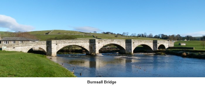
Start: Go
to the river and turn left to the stone bridge. Follow the footpath beyond
the bridge along the left hand side of the river. You will soon pass through a dramatic
limestone “gorge” (SE 030618).
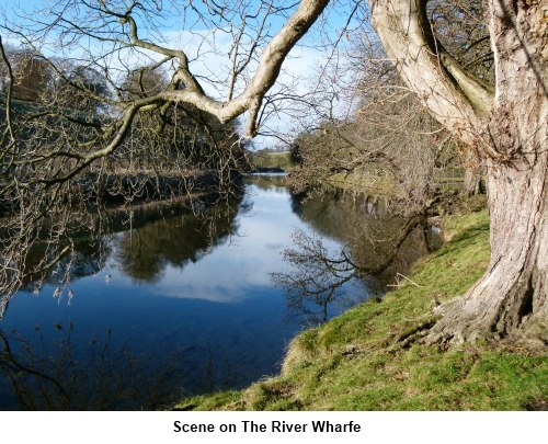
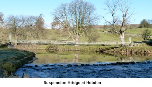
Follow
the river until you reach the suspension bridge below Hebden (SE 026624).
Cross over it carefully as it is narrow and has low sides. Once over the river,
turn left and continue to follow the river. As the path meets a sharp bend
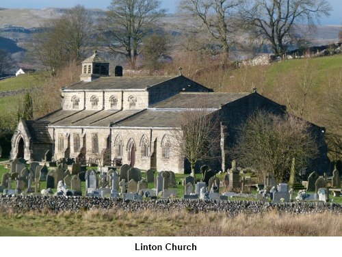
in the river, across the river you will see the picturesque Linton Church.
There are some stepping stones across the river should you wish to inspect
the church more closely but only attempt this at very low river levels. If
you go across, return after seeing the church.
The
footpath now turns right (north) away from the river for a short distance,
passing a fish farm. Just beyond here, a finger-post points left and takes
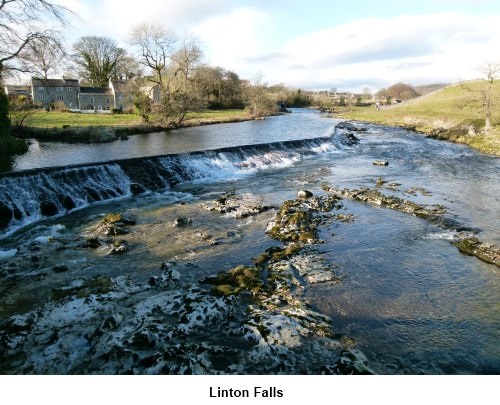
you back to the river again. Follow the riverside path until you come to the
footbridge at Linton where it is worth stopping to inspect Linton Falls (SE
001633). Especially after heavy rain, these can be very dramatic.
Turn
right at the bridge and follow the narrow, walled footpath. At the road turn
left into Grassington then right towards the market square. At the top of
the market square, take the left road (Main Street) and walk up the hill. As
you reach the village hall, turn right on to Garrs Lane with the triangle of
land used for parking on your right. Shortly beyond here, fork left on to
High Lane. High Lane becomes a stony walled track and Hebden is signed. Take
this route.
It is
now a case of following this track until it runs out and becomes a footpath.
Continue straight ahead following the obvious track to Hebden. You will pass
through Grassington Park Estate Meadows where a notice board explains about
the site being designated of Special Scientific Interest and the site of the
former Grassington Hospital. Through the trees across a driveway and over
the stone flags across the fields the route passes through some more trees
and continues to Hebden. The route is easy to follow and is more or less
straight ahead all the way.
You
arrive at the road close to a bus depot and more or less opposite the car
park for the Clarendon Hotel (SE 024631). Turn left.
Just past the Clarendon
Hotel itself, take the road on the right. Walk past the post office on the
right and the old school on the left. Just past the old school in the wall
on the left is an iron kissing gate. Go through this.
Walk
down to the beck and turn right to follow the footpath alongside it. You
will pass to the right of the start of the fish farm but then pass just to
the left of the main fish farm buildings. This part of the path is a narrow
footpath indicated by a finger post and you do not want the broad
track on the left.
The
footpath comes out on the road at a cluster of houses. Turn right and a few
yards later turn left at the finger post down to Hebden Suspension Bridge
which you crossed on the outward journey. Cross the bridge and turn left to
return to Burnsall.
If
you need to buy any hiking equipment/clothing before your trip see the Hiking
Store
All information on this
site is given in good faith and no liability is accepted in respect of any
damage, loss or injury which might result from acting on it.
|


.jpg)
.jpg)
.jpg)