|
Washburn
Valley and Timble
|
Starting
point and OS Grid reference:

At
turn off Otley to Bluberhouses road (SE 196492)
|
Ordnance
Survey Map
OS
Explorer Map 297 - Lower
Wharfedale & Washburn Valley.
Buy this map from
List
of OS Maps
Note: If you use OS Maps on-line, you can download this route via this
link.
| |
Distance: 8.4
Miles
| |
Traffic light rating:

(For explanation see My
Walks page)
| |


For advice on .gpx files see
My
Walks page
|

Click
the PDF logo above to give a printable version of this walk without the
photos.
|
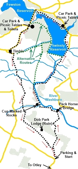
Introduction: Unusually for a valley in these parts and so
close to the major conurbations of Leeds/Bradford, no road runs through the
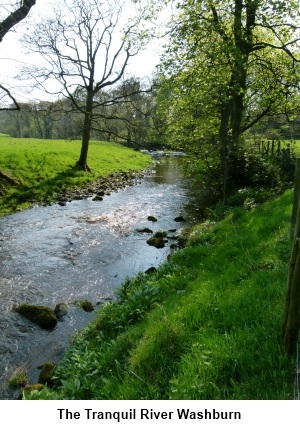
Washburn valley. As a result, it is a peaceful place. Apart from the
reservoirs, it is easy to imagine there has been no change for hundreds of
years. This is an easy walk with various interesting features and a joy
particularly in spring when the gorse and spring flowers predominate. It is
a good walk to initiate children into the joys of the countryside. There are
probabilities of seeing herons on the river.
The Timble Inn provides a possible lunch stop
but check the opening times before assuming availability.
This is one of my favourite walks.
The walk is very easy in term of gradient but
can be muddy underfoot in places. There are also a couple of places where
streams have to be crossed and where bridges were swept away a year or two
ago by floods. As long as there have been no recent heavy rains, you should
have no problems hopping across the stones. There is a plethora of footpaths
in this area and the walk can be lengthened, shortened or varied quite
easily. I have shown a couple of alternative paths as green dotted lines
which shorten the walk.
The parking spot is found by heading north
from Otley over its river bridge and up the steep hill. Pass the Roebuck pub
(known by everyone locally as The Spite from previous incarnations) Pass the
turn for Clifton, then the road turns sharply right then soon left. On this
left bend, there is a right “dead end” turn on to Dob Park Road
(unsigned) which you take. There
is limited rough parking immediately on the right of this lane (SE 196492). If
this parking is full, do not waste time going further down the lane as there
is no more parking. Instead, return to the road from which you turned and
continue for about ¾ of a mile where you will find parking on the right.
This walk can be combined with my Lindley
Wood Reservoir walk to provide a longer walk of some 13¼ miles
altogether.
To
view route as a dynamic Ordnance Survey map click here.
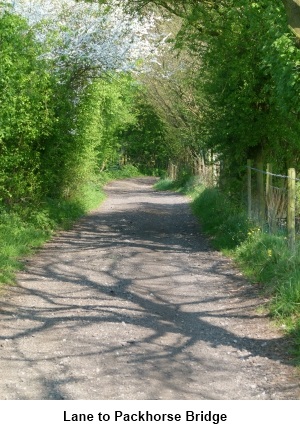
Start: From the Dob Park Road junction, walk down
the tarmac lane passing the old massive millstone which indicates you are
entering the Dob Estates. The lane becomes un-metalled as far as the old Dob
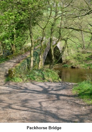
Park packhorse bridge over the River Washburn (SE 197509). Do not cross the
bridge but turn left just before it where the finger post indicates a public
footpath. There are scant remains of the old mill and goit. The route
follows the river so when the track forks, take the right fork.
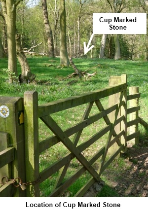
You arrive at some woods where cup marked
rocks are indicated on the OS map (SE 190510). A footpath yellow arrow left
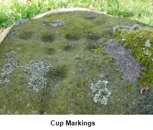
through the woods indicates where these are. We
do not want this path but it is worth a look at the ancient cup
markings. No-one knows what they were for. I have shown a photo from the
gate with an arrow to show the most easily found marked rock.
Shortly after
the woods with the cup marked rock, go through a gate and bear right. The
path across the stony/boggy ground is unclear at first but soon becomes
obvious.
A brook joins the river from the left. Cross
via the footbridge (SE 188518) and continue to follow the river. After
crossing the next stile, the footpath meets a broad track with a wide bridge
over the River Washburn (SE 191518).
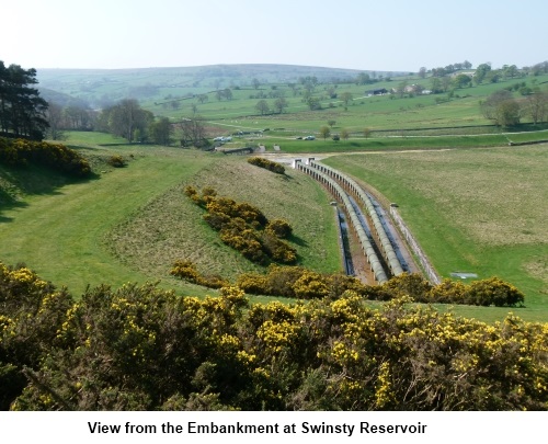
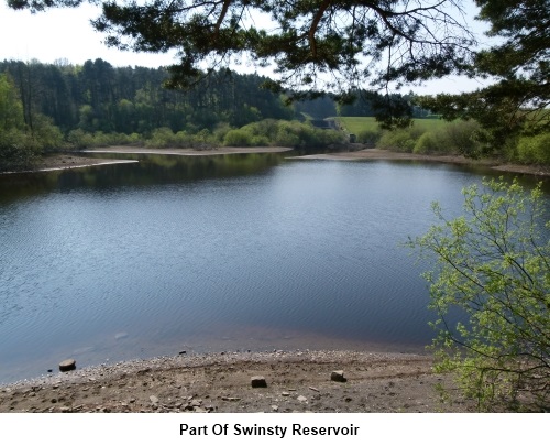
Cross this bridge then turn left and
continue to follow the river. Eventually after crossing a stone stile the
embankment of the dam forming Swinsty Reservoir appears ahead. Follow the
track to the right hand side of the dam. There are some pleasant spots here
for lunch.
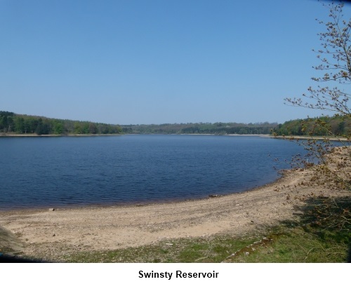
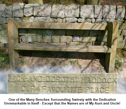
Turn right at the embankment and follow the drive from the house.
There are some benches along here and along the side of the reservoir which
we are to follow where again, lunch can be enjoyed.
After passing a bridge with walls at either
side and a metal fenced enclosure on the left, turn left to follow the
lakeshore until reaching a road. Turn left and go over the bridge and turn
left again to follow the shore of the reservoir (SE 199537). There are
picnic tables and car parking.
Round the side of the reservoir and at the
next road, turn left and cross the embankment between Swinsty (left) and
Fewston (right) reservoirs.
At the top of the rise with the car park on
the left (where there are toilets and picnic tables should you want them)
take the fork to the left of the “2000 monument” (SE 187538) along the
narrow lane signed unsuitable for long vehicles.
.jpg)
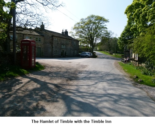
As you approach the hamlet of Timble, look
out for the red telephone box on the left. Turn left here (SE 188530) before
the Timble Inn and walk through to the tarmac lane. Turn left again and just
past Highfield Farm, look out for a narrow walled footpath on the right
signed “Dob Park” (SE 182528).
Just after the first bend in the path, look
out for a rough stile on the left. Cross and head down the field to the left
of the two gates. Pass through the gate and walk down the field keeping the
wall to your right. At the pair of gates at the bottom of the field, go
through the left gate and head for the opposite corner of the next field.
Cross the stile here and go over Timble Gill Beck and up the other side to
the top of the bank and continue with the wall on the left.
Head down the hill. At an old stile and place
where a gateway use to be, turn left and follow the path on the edge of a
section of slightly raised land (SE 183521). Power lines will be to your
right.
At a small group of trees, go through the
gate and follow the broad track.
Through the next gate, go straight ahead up
the hill keeping the wall on your right. A broad farm track awaits you
through the gate at the top of the field. The next bit is tricky so
concentrate! Follow the track through Washburn Farm (SE 185515) and as you
come to the front of the farm house, look for another farm track to the left
to another farm house. Turn left here, almost turning back on yourself for a
few yards. Turn right before a corrugated iron barn and look for a crude
gateway arrangement in the right hand corner. Go through this and continue
straight ahead keeping the wall on your right.
Cross a ladder stile at the top of the field
and look out for another to the right of Carr Farm. Go straight across the
farm lane and keeping the barn on your right pass through the sheep gates
heading for the ladder stile which you should be able to see. Head towards
the left corner of the next field. Ignore the gate but cross the poor
condition stone stile under a tree. Aim for a gate in the centre of the wall
at the end of the field and across the farm track (leading down to a ruined
farm), cross a strange contraption of a stile and continue to Midge Hall
farm. Over another strange precarious stile, bear right and you will see
Midge Hall Farm.
The track passes to the left of the farmhouse
and straight ahead over a stile and up the hill. At the top of the hill, at
the field boundary (SE 185505), turn left and follow the boundary. At the
next wall, the stile is collapsed but cross carefully and cross the field
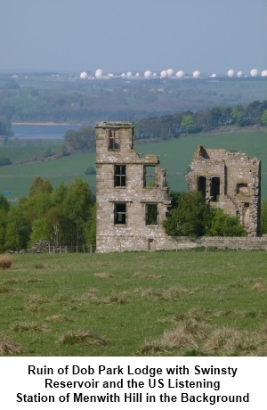
heading for the corner of the woods ahead (SE 187504). The route follows the
edge of the woods. There are fantastic views across the Washburn Valley and
the Menwith Hill “Golf Balls” (US listening station).
As you approach the end of the trees, look
out for a gate part way along the wall. Pass through the gateway into a
walled green lane. The ruins of Dob Park Lodge are to the left. Follow the
lane to the next gateway and immediately after it, turn right over the stile
and stick close to the boundary by the trees skirting Dob House Park Farm.
Over the next stile and turn right down the drive. On reaching the road,
turn right back to your start point.
If
you need to buy any hiking equipment/clothing before your trip see the Hiking
Store
All information on this
site is given in good faith and no liability is accepted in respect of any
damage, loss or injury which might result from acting on it.
|


.jpg)
.jpg)
.jpg)