|
Red
Pike and High
Stile
Starting point and OS Grid reference:

Pay
and display car park at Buttermere village (NY
173169)
|
Ordnance Survey Map
OL4
The English Lakes – North Western Area
Buy this map from
List
of OS Maps
Note: If you use OS Maps on-line, you can download this route via this
link.
| |
Distance: 7.7 miles
|
Date of Walk: 29 April 2011
| |
Ascent:
Descent:
See Walking Time Calculator
|
891m (2923ft)
891m (2924ft)
| |
Traffic
light rating: 

(For explanation see My
Walks page)
| |


For advice on .gpx files see
My Walks page
|

Click
the PDF logo above to give a printable version of this walk without the
photos.
|
To
view route as a dynamic Ordnance Survey map click here.
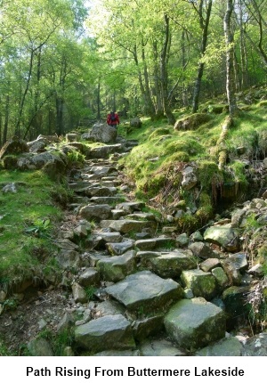
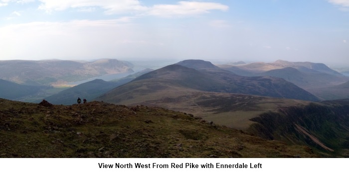
Introduction: This walk involves a very steep ascent up a
scree gully on to aptly named Red Pike and an equally steep descent from
Seat to Scarth Gap Pass. It is however a great ridge walk with contrasting
views from the almost unreasonable prettiness of the Buttermere Valley to
the north east and the rugged Scafell Range to the south east and a great
profile of Pillar. There are also views down the usually deserted Ennerdale
Valley.
Depending on your fitness and enthusiasm, the
walk could easily be lengthened to include Haystacks but after the ascent
and descents mentioned above this might be a climb too far!
Start: The walk starts from the car park at
Buttermere village (NY
173169) where you will need plenty of change to meet the cost! There
are toilets here too. Walk back down the car park road and turn right in
front of the Fish Hotel and follow the sign for Buttermere Lake down a broad
track. Where this forks, take the left fork. At the lake, turn right and
follow the line of the lakeshore towards the trees.
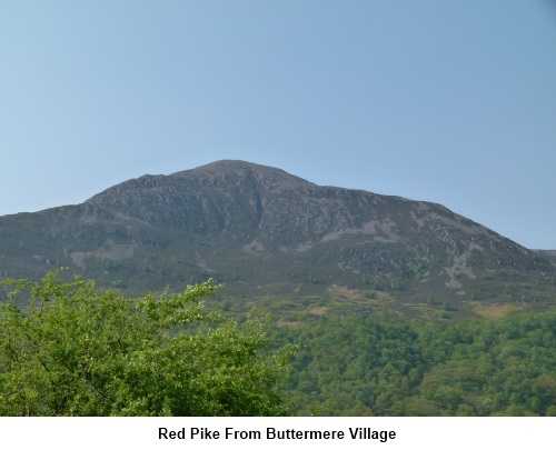
As you get to the corner
of the lake, cross over the stream on the little bridge and take the
attractive route through the trees on the steep stone stepped path (NY
173163).
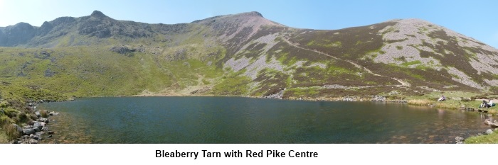
As you exit the trees stay on the obvious main path and you will
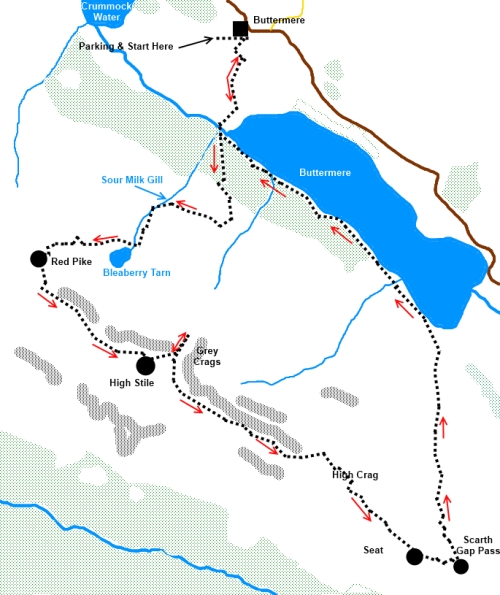
arrive at the gorgeous setting of Bleaberry Tarn (NY 167155) with Red Pike
rising above. The path to the summit is clear and it is obvious how the
mountain got its name.
Take the path up Red Pike. As you approach
the higher part, the path becomes ever steeper and loose shale makes for
frustrating walking. Eventually, you struggle up a narrow gully to achieve
the summit (NY 161155).
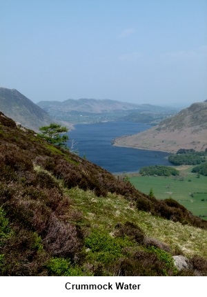
The summit itself is unremarkable having
little to mark it other than a crude shelter but the views are terrific of
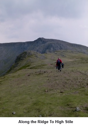
Crummock Water and Ennerdale. The route along the ridge heads south at first
before swinging south east to High Stile. There is a line of old iron fence
posts and if you keep to the left of these, you will arrive at High Stile.
However, do not keep them to your right beyond High Stile or you will meet a
sticky end! Some are close to the precipices!
There are some craggy outcrops between Red
Pike and High Stile which can provide a sheltered spot for lunch, depending
on wind direction.
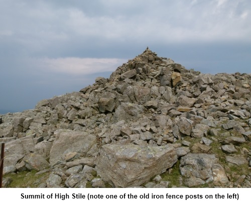
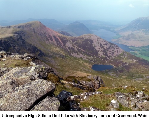
High Stile is marked by a large stone cairn
(NY 171149). The view from here along the ridge back to Red Pike is
dramatic.
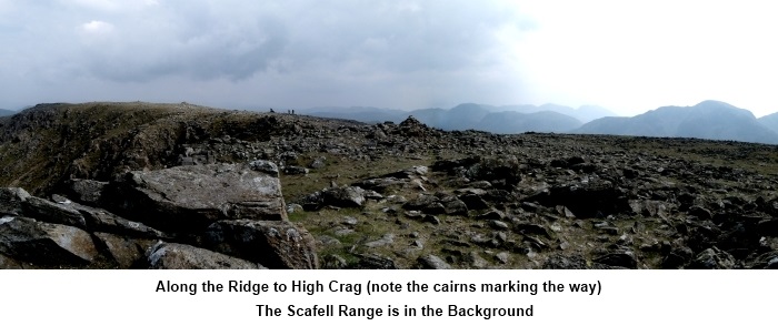
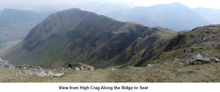
From the cairn, backtrack a few yards then
turn left and follow the ridge along to High Crag (NY 180141) and Seat (NY
186134). Stone cairns indicate the way.
There now begins an extremely steep descent
to Scarth Gap Pass. It is loose shale underfoot for a time and then the path
becomes “manicured” with stone steps having been laid. At the bottom, a
large stone cairn marks the pass (NY 189133). Straight ahead is the mass of
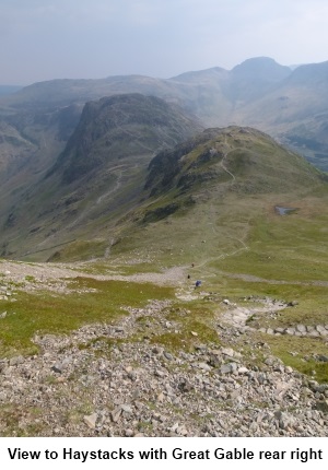
Haystacks but I decided to save this for another day.
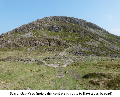
Turn left at the Scarth Gap Pass Cairn and
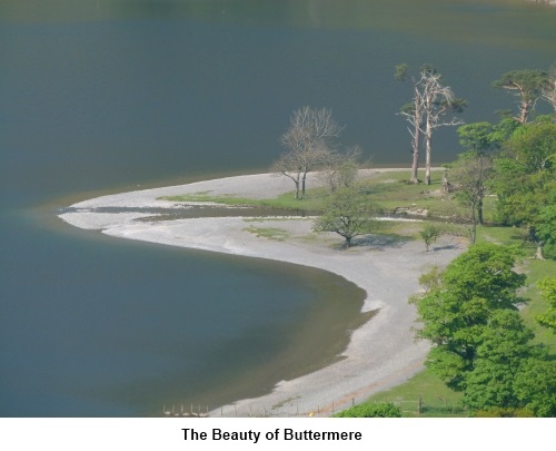
follow the obvious path down to the lakeshore. Turn left at the lake and
follow the shore back to Buttermere. This last mile or so alongside
beautiful Buttermere lake is a
welcome relief.
If you need to buy any hiking
equipment/clothing before your trip see the Hiking
Store
Before
venturing on to the Lake District fells, for your own safety, please check
the Fell
Top Conditions
All information on this
site is given in good faith and no liability is accepted in respect of any
damage, loss or injury which might result from acting on it.
|


.jpg)
.jpg)
.jpg)